
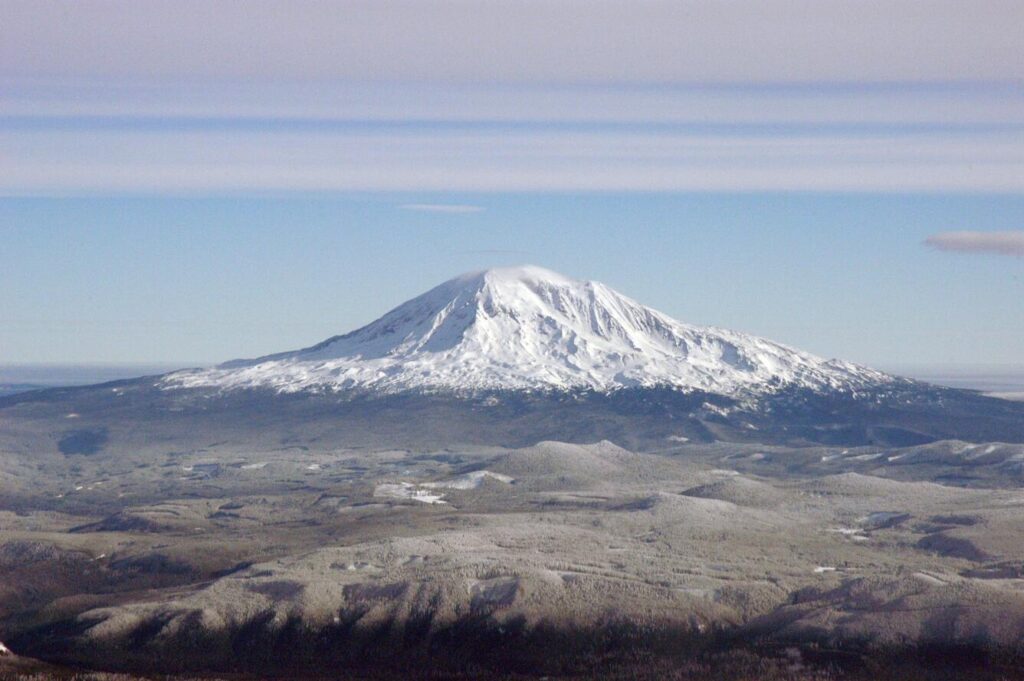
Mount Adams, seen here from Mount Saint Helens is the largest volcano by volume in the Cascade Range. (John Pallister/USGS)
Six low-intensity earthquakes rumbled beneath Mount Adams during September, according to the U.S. Geological Survey Cascades Volcano Observatory.
That’s an unusual amount of seismic activity at the 12,276-foot volcano in southwest Washington, marking the most earthquakes at the mountain in a month since monitoring began there in 1982. Even so, officials say there’s no imminent eruption threat. Mount Adams last erupted between 3,800 and 7,600 years ago.
The recent quakes were between the magnitudes of 0.9 to 2.0. Holly Weiss-Racine, a geologist with the Volcano Observatory, described them as “extremely small” and said people in the area wouldn’t have felt them. Typically the mountain sees about one earthquake every two or three years. Weiss-Racine said the September increase was “interesting” but “nothing meaningful.”
She explained that there are multiple indicators that a volcano might be “starting to wake back up” or going into a “period of unrest.” These include a large increase in earthquakes, ground deformation, and a surge in gas emissions.
“Right now, we’re not seeing any of those things,” Weiss-Racine added during an interview on Friday. “We’re just seeing these six earthquakes.”
Volcanoes can have a wide variety of background activity, including earthquakes. Mount Rainier, for instance, might have a couple of small earthquakes a day.
If Mount Adams were to erupt, deposits of rock and other material on the landscape suggest it would be much different than the cataclysmic 1980 blast at Mount St. Helens, which claimed 57 lives and spewed ash that traveled around the world in the days afterward.
“It’s not a very explosive volcano. It doesn’t produce a lot of ash,” said Weiss-Racine. Instead, geologic records suggest the volcano would produce thick, sticky lava flows. The build-up of this material is one reason Mount Adams is the largest by volume in the Cascade Range.
A hazard that would be a serious concern in an eruption at Mount Adams would be lahars – the volcanic mudflows that even a small eruption can produce. This slurry of melted glacier ice and rock could rush down river valleys and potentially into populated areas, like Trout Lake, Washington.
Mount Adams is located in southwest Washington. The community of Trout Lake, located about 13 miles south of the mountain, is one of the places that could be threatened by lahar flows in the event of an eruption.
September’s earthquakes seemed to be located beneath the center of Mount Adams. But because there’s only one monitoring station at the volcano, it’s difficult to pinpoint where the shaking occurred and how deep underground it was. The monitoring station is located about 7 miles southwest of the summit.
The Cascades Volcano Observatory installed an additional temporary seismic station at a trailhead yesterday and has plans to add two more at Mount Adams next week.
In 2019, Congress authorized a new volcano early warning and monitoring system. USGS has been working toward adding four more monitoring sites at Mount Adams using funding from that program but it is awaiting permits from the U.S. Forest Service to install the equipment. The new instruments will be more sophisticated than the one station at the mountain now.
Weiss-Racine said the Forest Service could wrap up its approvals within the next month, but that it may not be possible to get the new permanent stations in place until next year because the weather around the mountain will deteriorate heading toward winter.