
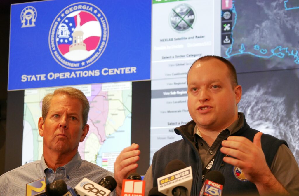
Gov. Brian Kemp (left) and Will Lanxton, who is the state meteorologist, briefed the media on the threats posed by Hurricane Helene on Thursday. Jill Nolin/Georgia Recorder
What remains of Hurricane Helene is expected to leave Georgia by midday Friday, likely leaving widespread – and potentially extended – power outages and a sprawling debris field in the massive storm’s wake.
On Thursday, state and local officials, agriculture leaders and residents from south Georgia to the Tennessee line were bracing for the worst as forecasts continued to paint a dire picture of what is to come.
Schools across the state closed ahead of the storm, and meetings and events – like GOP vice presidential nominee and Ohio U.S. Sen. J.D. Vance’s planned visits to Macon and Flowery Branch – were scuttled as Hurricane Helene barreled toward the Big Bend of Florida with an apparent path toward metro Atlanta. Some cities, like Valdosta, implemented a curfew.
Fast-moving Hurricane Helene, now a Category 4, is expected to make landfall sometime Thursday evening with a 400-mile girth that is expected to dump as much as a foot of rain in some areas of Georgia, bring powerful winds farther inland than usual and potentially even cause landslides in the mountainous areas of north Georgia.
“This is one of the biggest storms we’ve ever had,” Gov. Brian Kemp said Thursday afternoon during a storm briefing at the state operations center in Atlanta. “It may not be the strongest category, but from a wind field perspective and the amount of damage that it has the potential to do statewide, it’s better to be safe than sorry.
“It’s literally going to affect all 159 counties,” he added.
Kemp declared a statewide state of emergency on Tuesday, deploying personnel and resources across Georgia in advance of the storm. As of Thursday afternoon, Kemp said there was nothing more to do but wait.
“We’re as ready to go as we can but there’s just not much more we can do until the storm hits, the winds die down and we can come in there behind and start clearing roads and get power back on,” Kemp said.
The governor urged people to stay off the roads during and after the storm to give utility workers and recovery crews room to work.
Not your typical storm
Hurricane Helene is unusual among Georgia storms partly because of its reach, with it threatening tropical storm-strength winds – at a minimum – in areas of the state that are often spared such hurricane season rituals.
Lindsay Marlow, meteorologist with the National Weather Service in Peachtree City, said this marks one of only a few times metro Atlanta has ever been under a tropical storm warning in modern history.
“So, it’s fairly rare in terms of history for our forecast area, and you can kind of certainly see that translate to the types of impacts that we’re expecting,” Marlow said Thursday.
“This is a fairly anomalous storm, both in how broad its wind field is, and also in how quick its forward speed is. And the combination of those two factors is why we’re expecting kind of the magnitude of the inland impacts that we are.”
Marlow said an upper level low pressure system is pulling Hurricane Helene forward, giving the hurricane a faster than normal speed and less time to weaken as it travels through the state.
Since Hurricane Helene poses multiple threats that may occur during the night, knowing what to do and when to spring into action can be challenging.
“Kind of an insidious threat that comes with tropical systems on top of the potential for flooding and damaging wind gusts would also be the potential for short-lived fast-moving tornadoes, primarily on that eastern side of the storm,” Marlow said.
“So, it can be difficult to kind of process in that situation where you may already kind of be preparing for these stronger winds, having a tornado warning be issued on top of that.”
Meteorologists urge residents to make sure they can receive weather alerts, preferably in multiple ways – and make sure the volume on the devices is turned up.
“If you’re under a flash flood warning, you need to seek higher ground. If you’re in a tornado warning, you need to seek lower ground,” said Will Lanxton, who is the state meteorologist. “That’s two different things, two different actions to take, but you really need to be weather aware.”
State Rep. Will Wade, a Dawsonville Republican, said he feared Hurricane Helene might end up being one of the worst storms to hit Georgia in three decades.
“We’re preparing for what could be several days without power. We’re very concerned with the amount of saturation already on the ground here in my area,” Wade said.
‘We just have to pray that the miracle can happen for the farmers’
Before Hurricane Helene made landfall Thursday, it was already conjuring painful memories of Hurricane Michael and its devastating impact on the state’s agriculture industry, particularly its pecan orchards, in 2018.
Helene is moving into Georgia at a time when farmers are still gathering pecans and only starting to harvest cotton and peanuts.
But Helene’s likely statewide impact posed an even greater potential threat than Michael, stirring concerns throughout Georgia’s agriculture community.
“We’re talking about hurricane force winds upwards to Macon and Forsyth. When have we ever had hurricane force winds in that part of the state?” said the state’s agriculture commissioner, Tyler Harper.
“Now we’re talking tropical storm force winds in North Georgia. In that part of the state, you still have row crops, but you also have livestock and you have poultry facilities, and so it does cause a lot of concern,” he said.
Helene’s arrival also comes at a time when the agricultural economy is already under duress, Harper said.
“We have high input costs, high interest rates, low commodity prices,” he said. “So, as an ag economy, without a hurricane, we were going to be in a very tough place as is this year regardless. You throw a hurricane on top of that, it makes it a lot worse.”
Before a severe storm arrives, Georgia’s poultry farmers are advised to make sure that power generators are working and that propane tanks are topped off in case the electricity goes out. The Georgia poultry group also recommended supplying extra feed in case weather related disruptions restrict the ability to feed animals.
“You take all (Hurricane) warnings very seriously, but this one appears to have the potential to impact a very large area of land,” said Georgia Poultry Federation President Mike Giles. “The width of the storm is such that anywhere in Georgia, no matter where you are, could be potentially impacted.”
Don Koehler, who is the executive director of the Georgia Peanut Commission, said he is most concerned about the state’s cotton crop, which peanut farmers also commonly grow.
The cotton has already started shedding leaves, leaving the white bolls exposed to the elements. And with a harvest season that usually lasts a couple months, there was only so much cotton that could be quickly gathered ahead of the storm.
“When you take and you let that lint in that boll get wet and then you put 60 miles an hour wind on it, you know what’s going to happen. It’s going to blow it out. It’s going down to the ground,” Koehler said. “So, I’m fearful that the worst impact in our row crops is going to be cotton.”
Koehler said he is bracing for damage that is at least as bad as Hurricane Michael. But he knows if the forecasts are right and this storm maintains strength as far inland as expected, the impact could be far worse.
“The farmers know that it’s the risk that they take, but economically, we were already in a struggle,” Koehler said. “Too many bankers have told me that farmers were really in trouble this year because they carried debt. They really haven’t made any money for about three years now. They’ve carried debt forward and haven’t paid all their bills.
“So we were certainly needing a good crop this year, but we just have to pray that the miracle can happen for the farmers and that we make it by somehow,” he said.
SUPPORT NEWS YOU TRUST.