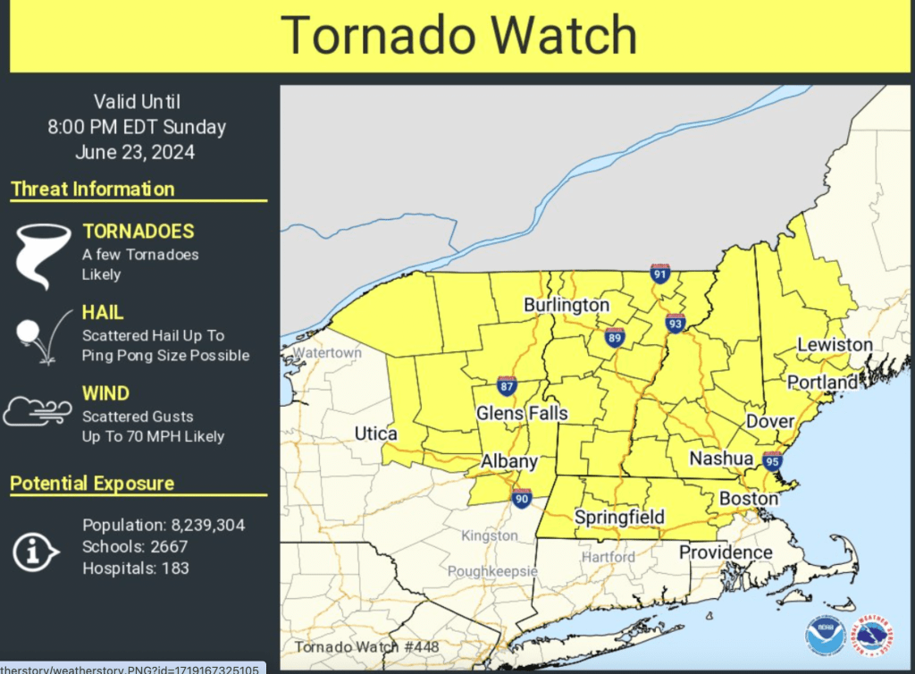
Image from National Weather Service of Burlington, VT.
Updated at 3:12 p.m.
The National Weather Service has placed the entire state of Vermont under a tornado watch until 8 p.m.
At around 2 p.m. on Sunday, it issued warnings for parts of Lamoille, Addison, Chittenden and Washington counties — meaning radar activity indicated a tornado could be imminent — but by 3 p.m. the storm had weakened and the warning expired.
Marlon Verasamy, a meteorologist with the National Weather Service in Burlington, said people in areas under a tornado warning should take shelter and go to either the center of their house or the basement, staying away from windows.
“Definitely if you’re outside, seek shelter as quickly and safely as possible.You need to get out of the exposed areas inside and get indoors immediately.”
The potential for severe weather on Sunday stems from the interaction of a warm front being followed by a cold front, Versamy explained. “We had a strong southerly push of warm weather that came into the air today, and then there is a very dynamic cold front that is coming through,” he said. “That’s kind of the kicker.”
Parts of the state were also placed under severe thunderstorm warnings on Sunday, with the possibility of hail and high winds.
Vermont only falls under a tornado watch or warning once or twice a year on average, according to Verasamy.
Noting that tornadoes can develop very rapidly, he urged people to both monitor the forecast and “keep your eyes to the sky.”
“If you see anything that looks threatening coming in your direction, by all means play it safe. Don’t always wait for a warning to come out,” he said. “We’re not telling everyone to like you know hunker down for the next eight hours but just, you know, be aware.”
Read the story on VTDigger here: Vermont remains under tornado watch.

